


From St. Leonhard along the Königssee stream to Rif
Die schnellste Verbindung zu diesem Ziel
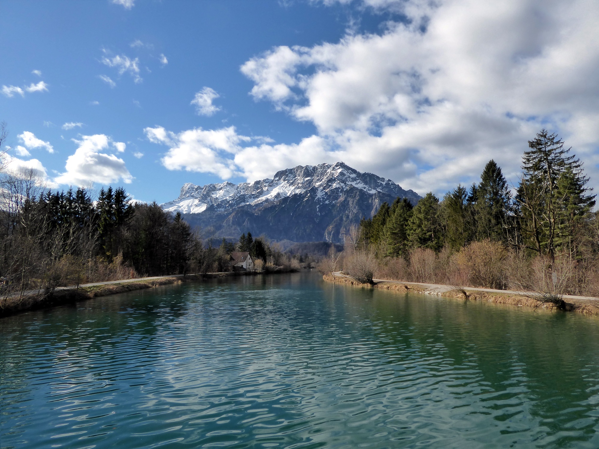
From St. Leonhard along the Königssee stream to Rif
A quiet riverside path accompanies the turquoise-blue Königssee stream on the last kilometers to its confluence with the Salzach.
Along the Königssee stream there is much to discover. This starts right at the starting point in St. Leonhard with a short visit to the sculpture park, which was created at the initiative of the cement manufacturer Leube. Most of the objects also consist of this important building material, whose base ingredient, marl lime, is extracted in high quality from the nearby Gutratberg. But how original the artists handle it! The material, weighing tons, is presented sometimes very light, almost floating, then again firmly anchored crosswise to the ground. The stream is worth a walk in every season. In the particularly cold winter months it sometimes even freezes over and invites you to dance on the ice. On hot summer days there is heavy use on the wide gravel banks, the clear water from the Königssee reaches almost bathing temperature. Let yourself be surprised, there is always something to see and experience along the stream.
leicht
2h 0min

6.69 km

Familienfreundlich

Kinderwagentauglich

A nach B

Grödig

Jahreszeiten


Wegbeschreibung
From the Grödig Untersbergbahn bus stop the route crosses the federal road as well as the Leube Bridge and sharply turns left at the left bridgehead onto the marked path, which reaches the Leube sculpture park in 15 minutes. The last artwork is the floating staircase, then the same way leads back to the bridge again. There the route runs a few meters along the street towards the Leube factory and then turns left onto the pedestrian bridge and from the opposite bridgehead to the right onto the towpath. After 1.5 km the federal road 159 is crossed in Taxach and now attractive riverside paths are offered on both sides of the stream. The one on the left riverbank makes a short detour through the Niederalm settlement in Flachgau, the Tennengau path on the right side leads permanently for 2 km along the shore to the Salzach mouth. On both sides of the border river between Tennengau and Flachgau, wonderful bays and gravel banks open up. Either over the Urstein power plant stage or 500 m upstream on the Salzach over the footbridge, the last section leads over the Salzach up to the Puch-Urstein train or bus stop.
Informationen & Kontakt
www.groedig.net
www.hallein.com
Mag. Christian Heugl
5400 Hallein
christian.heugl@gmail.com
Photo credit: Christian Heugl
Anfahrt mit den Öffis
From Salzburg main station take bus 25, bus 840, or trolleybus 5 to Grödig-Untersbergbahn. Return from the Puch-Urstein train stop with S3 or from Puch Urstein FH train stop with bus 160.
Interval / frequency: very good, including Sundays and public holidays.
Timetable information and download: Online at www.salzburg-verkehr.at or on your smartphone via the free Salzburg Verkehr app for Android and iOS.
Streckenprofil
Alle vorliegenden Inhalte hat die Redaktion nach bestem Wissen recherchiert. Die Redaktion der Salzburger Verkehrsverbund GmbH kann aber keine Gewähr für die Vollständigkeit, Korrektheit und Aktualität übernehmen. Wir bitten Sie, bei der Ausflugsplanung die Angaben zu überprüfen, da sich Öffnungszeiten, Eintrittspreise oder Informationen ändern können. Haftungsansprüche gegenüber der Redaktion oder der Salzburger Verkehrsverbund GmbH, welche sich auf Schäden materieller oder ideeller Art beziehen, die durch die Nutzung der dargestellten Informationen bzw. Nutzung fehlerhafter und unvollständiger Informationen verursacht wurden, sind grundsätzlich ausgeschlossen.