

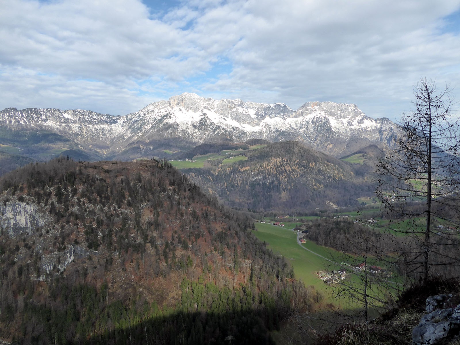

Lercheckerwand viewing platform
Die schnellste Verbindung zu diesem Ziel
Lercheckerwand viewing platform
A HISTORIC SALT HIKE WITH A WIDE VIEW BETWEEN BAD DÜRRNBERG AND BERCHTESGADEN.
The cross-border hike passes through a peaceful landscape, as harmonious as it could be. The borders are barely noticeable, neither linguistic nor geographical. During the time of the Archbishopric of Salzburg and the Prince Provostry of Berchtesgaden, however, the relationship between the two salt producers was not always so conflict-free. The valuable salt, the cause of many disputes, is no longer mined in Dürrnberg, but the traces are still plentiful: old mine entrances, boundary stones marking property rights, or former mining buildings can be found on the interesting route, marked with the miners’ tools hammer and pick. The highlight and highest point is the short detour to the Lercheckerwand viewing platform (985 m). Just like the historical arc, the magnificent panorama extends from the city of Salzburg in the north over the Untersberg to Berchtesgaden.
leicht
2h 30min

6.68 km

Familienfreundlich

A nach B

Berchtesgaden

Jahreszeiten


Wegbeschreibung
From the bus stop Bad Dürrnberg-Kranzbichlhof at the turnaround point of line 41, the route passes the Health Hotel Kranzbichlhof, crosses the border where an antique shop has moved into the former customs house. About 100 meters after the border, the marked path 31 “Lerchecker Wand” branches off to the right, crosses the hollow and then leads steeply uphill into the forest. Behind it opens up a beautiful upland, over which it goes slightly downhill to another junction (right) at a striking solitary tree. At the highest point, a short side path to Lercheckerwand branches off to the right shortly afterwards, but the descent to Oberau continues straight south. The forest path meets the driveway and follows it, turning right twice, to Oberau. In the village, the route passes the tourist office and now follows the signage “Gmerk via toboggan run” (path 8/33). About 140 meters above, the route meets the Roßfeld Höhenringstraße and follows it briefly to the left, then right into the district of Gmerk. The paved path 8 to Bad Dürrnberg crosses the border and leads steeply past the Teufenbach tunnel down to the bus stop Bad Dürrnberg Zinkenlift.
Informationen & Kontakt
www.salzwelten.at; www.berchtesgaden.de/wandern; https://duerrnberg.at/sommer/wandern/;
Mag. Christian Heugl
5400 Hallein
Image credit: Christian Heugl
Anfahrt mit den Öffis
By bus 160, 170 or by train to Hallein. By bus 41 to Bad Dürrnberg Kranzbichlhof. Return by bus 41 from Bad Dürrnberg Zinkenlifte.
Timetable information and download: Online at www.salzburg-verkehr.at or on your smartphone via the free Salzburg Verkehr app for Android and iOS.
Streckenprofil
Alle vorliegenden Inhalte hat die Redaktion nach bestem Wissen recherchiert. Die Redaktion der Salzburger Verkehrsverbund GmbH kann aber keine Gewähr für die Vollständigkeit, Korrektheit und Aktualität übernehmen. Wir bitten Sie, bei der Ausflugsplanung die Angaben zu überprüfen, da sich Öffnungszeiten, Eintrittspreise oder Informationen ändern können. Haftungsansprüche gegenüber der Redaktion oder der Salzburger Verkehrsverbund GmbH, welche sich auf Schäden materieller oder ideeller Art beziehen, die durch die Nutzung der dargestellten Informationen bzw. Nutzung fehlerhafter und unvollständiger Informationen verursacht wurden, sind grundsätzlich ausgeschlossen.