


From Lofer via Mayrberg to Reith
Die schnellste Verbindung zu diesem Ziel
From Lofer via Mayrberg to Reith
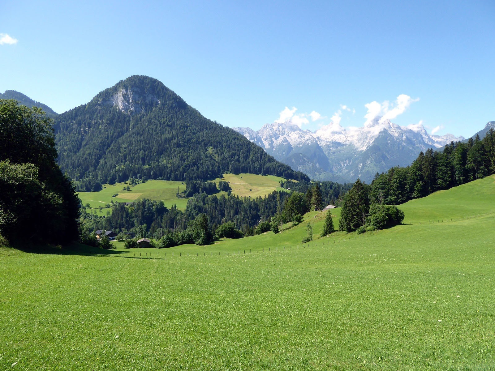
IDEAL FOR HOT SUMMER DAYS: AT THE BEGINNING AND END OF THE ROUTE, LITTLE-KNOWN GORGES, WITH A GENTLE TRANSITION AT THE FOOT OF THE REITER ALPE IN BETWEEN.
The Saalach Valley is also called the “Valley of the Gorges.” Actually, it is the many tributaries that flow from the limestone mountains into the second longest river in the country, and depending on geological conditions, form the spectacular gorges and ravines before joining. During this varied circular hike, the streams from the Reiter Alpe offer impressive experiences and cause a higher water level in the Saalach. The Mayrberg Gorge and the Innersbach Gorge are not among the largest gorges in the Saalach Valley; instead, these quiet beauties remain quite peaceful. There is certainly enough to marvel at. Especially the Innersbach Gorge, more of a crevice than a gorge, really leaves one speechless. At the end of the short, well-secured crossing, a very special rock whirlpool awaits as a challenge for the brave.
leicht
2h 45min

8.37 km

Familienfreundlich

A nach B

Lofer

Jahreszeiten


Wegbeschreibung
The starting point is the Lofer Antonikapelle stop in the Maurach district. Path 53 towards Au passes under the federal road and immediately reaches the chapel built in 1755. Hiking trail 64 (Mayrberg Gorge) branches off towards the Auer Bridge downhill, then after crossing, turns left—first along the Saalach, then along the Mayr stream—straight into the Mayrberg Gorge, which is cut up to 40 m deep. At the end, at a fork, the right path leads in a few minutes up to the photogenic Auer little church. Our Route 64 to Obermayrberg, however, turns left into the cool forest. 2.5 km later, the path reaches a beautiful clearing and the highest point in Mayrberg. Passing the proud Moarhof (889 m), Route 4 (Reith, Innersbach Gorge) joins a forest road and follows it downhill for over 2 km. In Reith, the path turns right into the short but breathtakingly narrow Innersbach Gorge and, at the exit, in a few minutes leads to the left to the bridge over the Saalach with the subsequent Reith stop. Those who want to return to the starting point Antonikapelle should first turn onto the “Au, Mayrberg Gorge” path (1 hour).
Informationen & Kontakt
Mag. Christian Heugl
5400 Hallein
cheugl@a1.net
Image credit: Christian Heugl
Anfahrt mit den Öffis
From Salzburg main station (Engelbert-Weiß-Weg) by bus 260 to Lofer Antonikapelle.
Return from Lofer Reith with bus 260 towards Salzburg main station.
Timetable information and download: Online at www.salzburg-verkehr.at or on your smartphone via the free Salzburg Verkehr app for Android and iOS.
Streckenprofil
Alle vorliegenden Inhalte hat die Redaktion nach bestem Wissen recherchiert. Die Redaktion der Salzburger Verkehrsverbund GmbH kann aber keine Gewähr für die Vollständigkeit, Korrektheit und Aktualität übernehmen. Wir bitten Sie, bei der Ausflugsplanung die Angaben zu überprüfen, da sich Öffnungszeiten, Eintrittspreise oder Informationen ändern können. Haftungsansprüche gegenüber der Redaktion oder der Salzburger Verkehrsverbund GmbH, welche sich auf Schäden materieller oder ideeller Art beziehen, die durch die Nutzung der dargestellten Informationen bzw. Nutzung fehlerhafter und unvollständiger Informationen verursacht wurden, sind grundsätzlich ausgeschlossen.