


From Bischofshofen to the Hochkeil
Die schnellste Verbindung zu diesem Ziel
From Bischofshofen to the Hochkeil
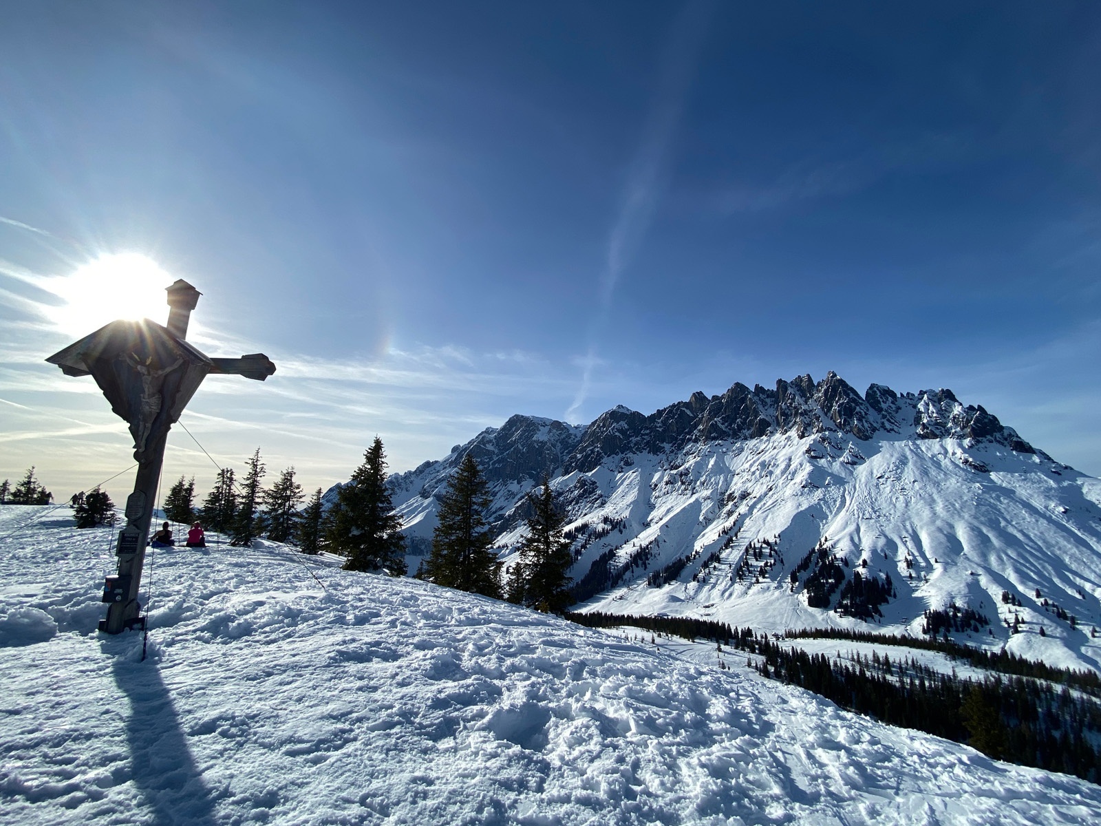
Long but easy ski route on the Hochkeil in Mühlbach with a fantastic panoramic view of the Hochkönig.
Longer but easy and relatively avalanche-safe ski route from Bischofshofen to the Hochkeil. The ascent is signposted and mostly leads through open terrain off-piste through the forest. At the summit, you stand directly in front of the impressive Hochkönig massif and meet many ski tourers who have ascended from Arthurhaus. The panoramic view is impressive. From the summit, you descend via the Hochkeil ski piste and turn halfway to the specially prepared forest path Knappensteig for ski tourers. From there, it goes back to Bischofshofen.
mittel
3h 55min

16.43 km

Rundtour

Bischofshofen

Jahreszeiten


Wegbeschreibung
Provided there is sufficient snow cover, the route can start in the Schanzengelände of Bischofshofen. Always well signposted, it first goes through the forest and over some open meadows past the Gasthof Bürglhöh before leaving the prepared part by turning left and ascending on the long east ridge through quiet snowy forests to the summit. The descent takes place via the Hochkeil ski piste and halfway down, it turns onto the prepared forest path Knappensteig, which leads back to the starting point.
Informationen & Kontakt
Hochkeil ski area:
Theresa Schilling
5020 Salzburg
theresaschilling@googlemail.com
Image credits: Theresa Schilling, Per Oftedal
Anfahrt mit den Öffis
Bischofshofen train station, where local trains and long-distance trains run several times per hour. From there, it is about a 10-minute walk through the town to the starting point.
Timetable information and download: Online at www.salzburg-verkehr.at or on your smartphone via the free Salzburg Verkehr app for Android and iOS.
Sicherheitshinweise
Observe the avalanche warning level! Complete ski touring equipment. Weather and avalanche information at www.lawine.salzburg.atStreckenprofil
Alle vorliegenden Inhalte hat die Redaktion nach bestem Wissen recherchiert. Die Redaktion der Salzburger Verkehrsverbund GmbH kann aber keine Gewähr für die Vollständigkeit, Korrektheit und Aktualität übernehmen. Wir bitten Sie, bei der Ausflugsplanung die Angaben zu überprüfen, da sich Öffnungszeiten, Eintrittspreise oder Informationen ändern können. Haftungsansprüche gegenüber der Redaktion oder der Salzburger Verkehrsverbund GmbH, welche sich auf Schäden materieller oder ideeller Art beziehen, die durch die Nutzung der dargestellten Informationen bzw. Nutzung fehlerhafter und unvollständiger Informationen verursacht wurden, sind grundsätzlich ausgeschlossen.