


Small, but with respect: mountain route to the Sparber near Strobl
Die schnellste Verbindung zu diesem Ziel
Small, but with respect: mountain route to the Sparber near Strobl
A wonderful hike in the Salzkammergut mountains. 💙 Attention ‼️: surefootedness and a head for heights are required.
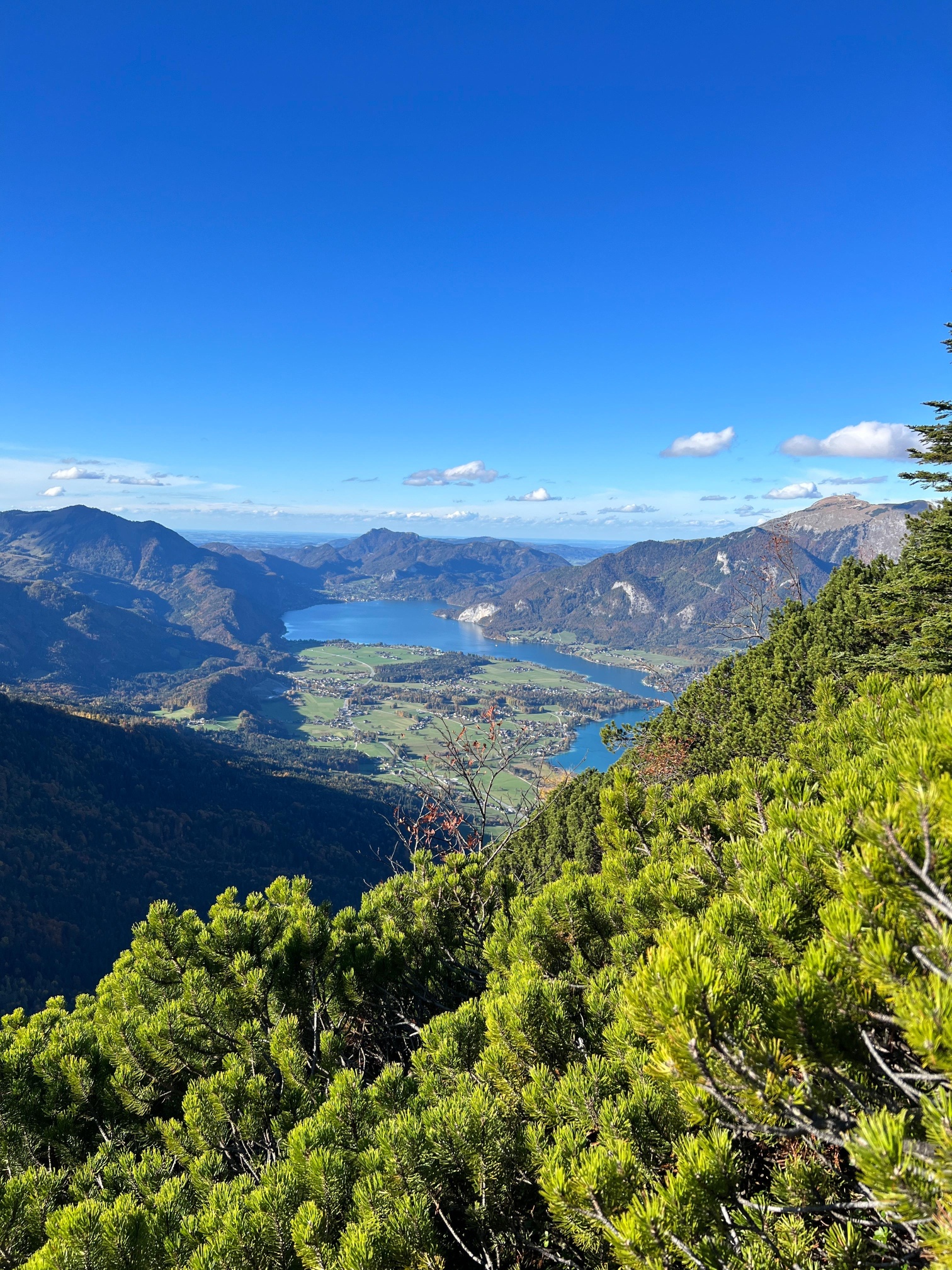
Salzkammergut is a beautiful mountain and lake region in Salzburg and Upper Austria, which offers not only numerous tourist attractions but also a true paradise for mountaineers. The hike to the 1,502 m high Sparber is one of the most beautiful in the region. The route is very varied and exciting. From the summit, you have a dreamlike view of Wolfgangsee as well as the numerous peaks of the Salzkammergut such as Schafberg, Bleckwand, Rettenkogel, and others. But caution: the route starts as an easy mountain hike and ends with a steep and exposed section with several ladders and points secured with steel cables. The exposed sections are, however, unproblematic for experienced mountain hikers, and the ladders do not pose a problem either.
Direct travel and details at: salzburg-erfahren.at
mittel
4h 0min

10.01 km

Hin und Zurück

Strobl

Jahreszeiten


Wegbeschreibung
The starting point of this hike is the bus stop “Strobl Weißenbach.” First, you cross the village and walk uphill on a road to the guesthouse Kleefeld. After about 30 minutes, you reach the petting zoo which belongs to the guesthouse. To the left of the house, the route continues on a forest road. After a few minutes, you can shorten the route through a short but steep wooded section, until you reach the forest road again. After about one kilometer, the path leads to the right through very beautiful forest terrain. Over stones and roots, you reach the unmanaged Dürntalalm. Now the well-marked path climbs over the alpine meadow until the route leads back into the forest. Here, the route turns southeast and goes over a gentle forest ridge below rock walls. Below the notch, you cross very steep grassy slopes to the saddle between the Great and Small Sparber. Here, two small ladders must be overcome. From this point, the route becomes more demanding and especially exposed. Shortly after the notch, some altitude must be descended. Here begins the last, secured section. Over another ladder, you overcome a rock step and then reach the very steep, pine-covered west flank of the Sparber. Finally, you climb along further protections to a ladder. This is about 12 m long and ends shortly below the summit. From here, the path leads steeply uphill over rocky terrain and pine corridors to the 1,502 m high summit. The descent follows the same route.
Anfahrt mit den Öffis
By bus 150 to Strobl Weißenbach.
Timetable information and download: Online at www.salzburg-verkehr.at or on your smartphone via the free Salzburg Verkehr app for Android and iOS.
Direct travel and details at: salzburg-erfahren.at
Sicherheitshinweise
Surefootedness and a head for heights.Streckenprofil
Alle vorliegenden Inhalte hat die Redaktion nach bestem Wissen recherchiert. Die Redaktion der Salzburger Verkehrsverbund GmbH kann aber keine Gewähr für die Vollständigkeit, Korrektheit und Aktualität übernehmen. Wir bitten Sie, bei der Ausflugsplanung die Angaben zu überprüfen, da sich Öffnungszeiten, Eintrittspreise oder Informationen ändern können. Haftungsansprüche gegenüber der Redaktion oder der Salzburger Verkehrsverbund GmbH, welche sich auf Schäden materieller oder ideeller Art beziehen, die durch die Nutzung der dargestellten Informationen bzw. Nutzung fehlerhafter und unvollständiger Informationen verursacht wurden, sind grundsätzlich ausgeschlossen.