


From Großarl to the Saukarkopf
Die schnellste Verbindung zu diesem Ziel
From Großarl to the Saukarkopf
The Großarler hiking menu is served: the first course at the Gerstreitalm, the main course on the Saukarkopf, and the dessert before the long descent at the Saukaralm.
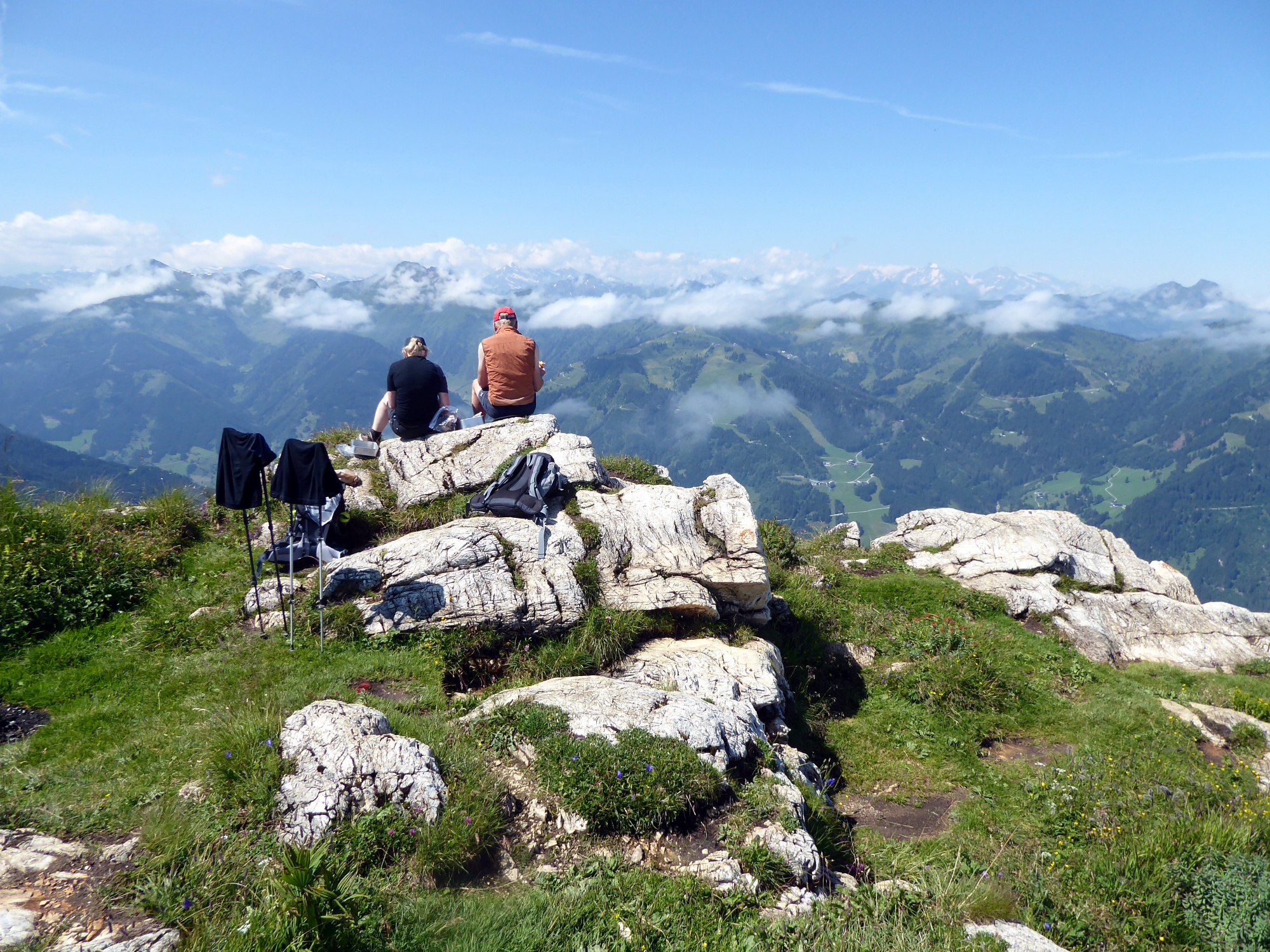
The three-hour ascent from the town center in Großarl to the Saukarkopf progresses quite briskly on beautiful forest and meadow paths. The descent to the Wimmbrücke stop, 7 km away, mostly follows forest roads. Culinarily, the southwest side of the Saukarkopf makes stronger accents with the wonderful Gerstreit and the rustic Saukaralm. The highest point of the crossing is the rocky Saukarkopf (2048 m), which looks almost unconquerable from afar. The summit path is steep but by no means dangerous. The view is stunning, stretching from Dachstein to Großglockner.
schwer
6h 15min

14.91 km

A nach B

Großarltal

Jahreszeiten


Wegbeschreibung
From the Großarl town center stop, the path leads again 250 m along Marktstraße downhill and then turns right onto the marked route 65 (Gerstreitalm, Saukarkopf). After a bend, we leave the narrow mountain road and hike past the viewing platform “Hertas Rast” always following path 65, or from the fork following path 65a to the Gerstreitalm (open daily late May to November 1). After the previously rather leisurely traverse, the path towards Saukarkopf increases in steepness up to the unstaffed Reschenbergalm, then follows a flat section again and finally concludes with the really sweat-inducing half-hour summit trail. Back at the fork, the path leads to the Saukaralm, only a few minutes away (open depending on weather. Tel. +43 664 5318692) and then follows the forest road to the first sharp bend. Exactly here the unfortunately no longer marked old summer path continues straight ahead and after 30 minutes merges back into the forest road near a private hut. After many bends, the Höllingwald forest road meets the Sonneggweg (access to Breitenebenalm) and follows this left turn for another 2.5 km down to the Wimmbrücke stop on the Großarler Landesstraße.
Informationen & Kontakt
www.grossarltal.info/de/sommer/tal-der-almen/die-almen.html
Mag. Christian Heugl
5400 Hallein
christian.heugl@gmail.com
Image credit: Christian Heugl
Anfahrt mit den Öffis
From St. Johann station (forecourt) take bus 540 to Großarl town center. Return from the Großarl Wimmbrücke stop with bus 540 to St. Johann station and then continue by train.
Timetable information and download: Online at www.salzburg-verkehr.at or on your smartphone via the free Salzburg Verkehr app for Android and iOS.
Streckenprofil
Alle vorliegenden Inhalte hat die Redaktion nach bestem Wissen recherchiert. Die Redaktion der Salzburger Verkehrsverbund GmbH kann aber keine Gewähr für die Vollständigkeit, Korrektheit und Aktualität übernehmen. Wir bitten Sie, bei der Ausflugsplanung die Angaben zu überprüfen, da sich Öffnungszeiten, Eintrittspreise oder Informationen ändern können. Haftungsansprüche gegenüber der Redaktion oder der Salzburger Verkehrsverbund GmbH, welche sich auf Schäden materieller oder ideeller Art beziehen, die durch die Nutzung der dargestellten Informationen bzw. Nutzung fehlerhafter und unvollständiger Informationen verursacht wurden, sind grundsätzlich ausgeschlossen.