


From Koppl-Gruberfeld over Heuberg to Eugendorf
Die schnellste Verbindung zu diesem Ziel
From Koppl-Gruberfeld over Heuberg to Eugendorf
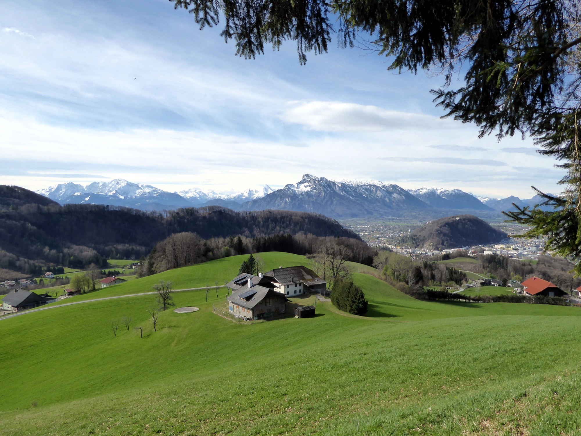
A rather gently marked hike over the last foothill of the Eastern Alps before the flysch zone and with it the gentle lake landscape begins.
A route for “path finders” that requires some sense of direction at certain junctions! But the south-north crossing from the Koppl district of Gruberfeld to Eugendorf is nevertheless worthwhile, and with the salzburg-erfahren.at homepage in your backpack, orientation shouldn’t be a problem. The name “Howberga” (=Heuberg) first appeared in a document in 1141 and refers to the agricultural significance—at least on the south side. Forests dominate in the north, where the old name “Petersberg” points to affiliation with St. Peter’s Abbey.
leicht
3h 0min

8.72 km

A nach B

Eugendorf

Jahreszeiten


Wegbeschreibung
The starting point is the Koppl – Gruberfeldsiedlung stop. Through the underpass of the federal road, then past the futuristic Biogena building, the route turns right (sign WWW 10), crosses the ditch and the Alterbach and meets a driveway. Here, just a few meters to the right, then immediately again steeply uphill to the left past the house chapel. The route merges into Heubergstraße, which leads to the last farm. Pass this on the left, then along the tractor path to the right along the forest edge to the next farm and there diagonally opposite to cross into the meadow path, which reaches the Heuberg ridge a few meters later. Now always follow the ridge, first slightly below on the service road, then directly over the ridge path to the highest point (according to the map 901 m, according to the summit cross 899 m). The forest path leads northeast past the ASKO-Heuberg Trail, then meets the new 380 kV power motorway and follows it briefly to a fork. Now turn right, likewise 1 km later at the junction with an access road. Either stay on this or immediately cross the meadow on the left to the Hotel-Restaurant Hochfuchs. To the right of the striking building begins an unmarked tractor path that runs steeply downhill along the former ski slope "Thalgauberg." After merging into a farm driveway, follow this to the left, then turn right onto Rappenwangerstraße and through the motorway underpass past the furniture stores to the Eugendorf Straße stop.
Informationen & Kontakt
https://fuschlsee.salzkammergut.at/oesterreich-poi/detail/430012421/tourismusverband-fuschlseeregion-ortsbuero-koppl.html, www.eugendorf.at/Tourismusverband_Eugendorf
Mag. Christian Heugl
5400 Hallein
christian.heugl@gmail.com
Photo credit: Christian Heugl
Anfahrt mit den Öffis
By bus 150 or 155 from Salzburg main station (Südtiroler Platz) to Koppl Gruberfeldsiedlung.
Return from the stop Eugendorf Straße to Salzburg main station with bus 130 or 140.
Timetable information and download: Online at www.salzburg-verkehr.at or on your smartphone via the free Salzburg Verkehr app for Android and iOS.
Streckenprofil
Alle vorliegenden Inhalte hat die Redaktion nach bestem Wissen recherchiert. Die Redaktion der Salzburger Verkehrsverbund GmbH kann aber keine Gewähr für die Vollständigkeit, Korrektheit und Aktualität übernehmen. Wir bitten Sie, bei der Ausflugsplanung die Angaben zu überprüfen, da sich Öffnungszeiten, Eintrittspreise oder Informationen ändern können. Haftungsansprüche gegenüber der Redaktion oder der Salzburger Verkehrsverbund GmbH, welche sich auf Schäden materieller oder ideeller Art beziehen, die durch die Nutzung der dargestellten Informationen bzw. Nutzung fehlerhafter und unvollständiger Informationen verursacht wurden, sind grundsätzlich ausgeschlossen.