


To the Dötzenkopf – the “smallest” 1000 meter peak of the Berchtesgadener Alps
Die schnellste Verbindung zu diesem Ziel
To the Dötzenkopf – the “smallest” 1000 meter peak of the Berchtesgadener Alps
This short but slightly alpine hike to the 1001 m high summit between Bad Reichenhall and Bayerisch Gmain is worth doing at any time of the year. The Dötzenkopf is popular not only with families but also as an after-work route in the Berchtesgadener Land. The hike to the summit takes only about an hour and is rewarded with a breathtaking view over the Alpine town of Bad Reichenhall and the surrounding mountain landscape.
Although the path to the Dötzenkopf is short, it is steep and has slightly alpine terrain. At 1,001 m, it is the lowest 1000 meter peak in the Berchtesgadener Alps. The hike to the Dötzenkopf starts at the Bayerisch Gmain hiking car park and follows the wide path marked “Dötzenkopf”. Shortly after, you have to cross the Wappbach. In summer, the cool water with its pools invites you to splash and play.
Opposite, you go up a moderately steep path and through the forest. After about 30 minutes, we turn right and take a break on the viewing bench at Wappachkopf.
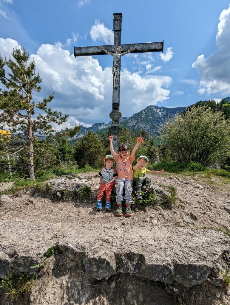
From here, the path gets steadily steeper. Just before the Dötzenkopf summit it becomes rockier and more alpine; surefootedness is essential here. The route is not easy but varied and quite attractive – also for children. The four benches on the summit invite you to a cozy snack while butterflies flutter around you and you enjoy a magnificent view.
mittel
2h 30min

5.31 km

Familienfreundlich

Hin und Zurück

Bavarian Gmain

Jahreszeiten


Informationen & Kontakt
Detailed information about the hike to the Dötzenkopf
Information & contact
Thomas Grah & Kristina Karl
5061 Elsbethen
Instagram: @adventuremo.de
Blog: www.adventuremo.de
Photo credit: Kristina Karl
Anfahrt mit den Öffis
By regional bus 180, for example from Salzburg Aiglhof via Großgmain to Bayrisch Gmain town.
Timetable information and download: Online at www.salzburg-verkehr.at or on your smartphone via the free Salzburg Verkehr app for Android and iOS.
Streckenprofil
Alle vorliegenden Inhalte hat die Redaktion nach bestem Wissen recherchiert. Die Redaktion der Salzburger Verkehrsverbund GmbH kann aber keine Gewähr für die Vollständigkeit, Korrektheit und Aktualität übernehmen. Wir bitten Sie, bei der Ausflugsplanung die Angaben zu überprüfen, da sich Öffnungszeiten, Eintrittspreise oder Informationen ändern können. Haftungsansprüche gegenüber der Redaktion oder der Salzburger Verkehrsverbund GmbH, welche sich auf Schäden materieller oder ideeller Art beziehen, die durch die Nutzung der dargestellten Informationen bzw. Nutzung fehlerhafter und unvollständiger Informationen verursacht wurden, sind grundsätzlich ausgeschlossen.